
Hike the Las Vegas Overlook Trail for Spectacular Views of Red Rock Canyon
The Las Vegas Overlook hiking trail is a moderate 4-mile hike that will leave you with incredible views of the Red Rock National Conservation Area and the Las Vegas strip. The trail is easy to follow up and back with no scrambling but can get steep in parts as you go up about 1000 feet in elevation.
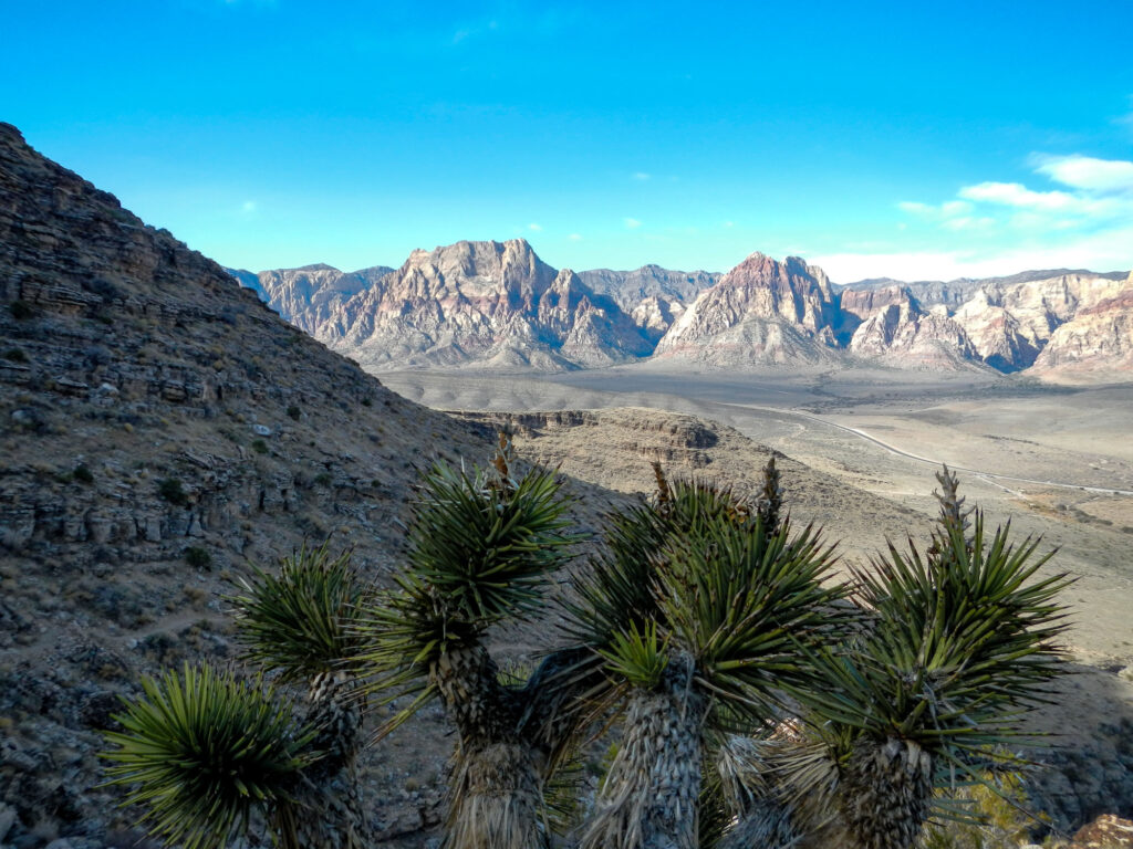
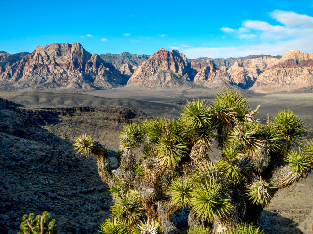
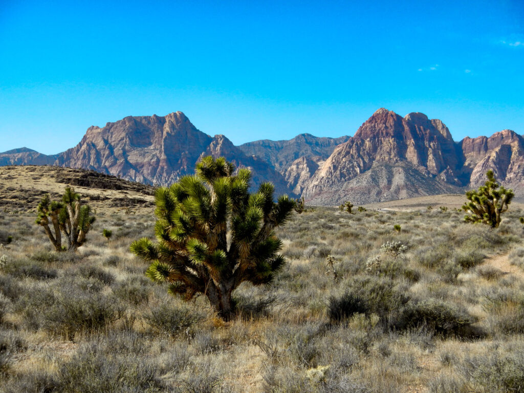
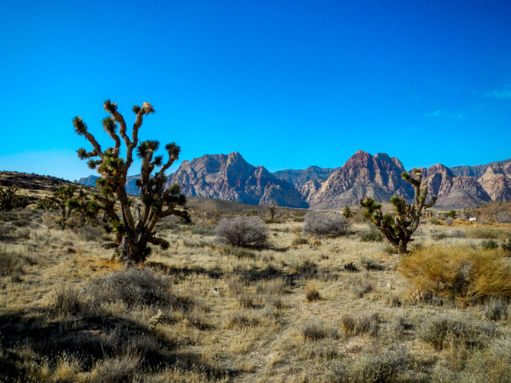
The Las Vegas Overlook Trail combines a nice desert hike through Joshua Trees with multiple switchbacks as you hike your way up Blue Diamond Hill to the Muffin Top. Once you reach the top, pause for a while and enjoy the amazing view.
This hike is strenuous at points and there are some steep drop-offs along the way so I would not recommend it for younger children but dogs should be fine. There is not a lot of shade on the trail so remember to bring plenty of water and comfortable trail shoes.
How to Get to the Las Vegas Overlook Trail
The trail starts at the Cowboy Trails parking lot across from the Red Rock National Conservation Area. To get there travel towards Red Rock Canyon National Conservation Area on State Highway 159, instead of pulling into the scenic loop just park 1 mile south of the scenic loop entrance at the lot for the Cowboy Trails horse riding stables.
Since the Las Vegas Overlook Trail is outside of the Red Rock National Conservation area there is no entry fee to access this trail. Along with the picturesque views, this makes it a very popular trail so parking fills up quickly. Try to get there early and beat the crowds.
Insider Tips For Hiking the Las Vegas Overlook Trail
From the parking lot walk through the gate and follow the gravel road past a shed and to the pen where the horses are held. Immediately after the pen, there will be a trail on your left side that walks along the pen and takes you through a wash.
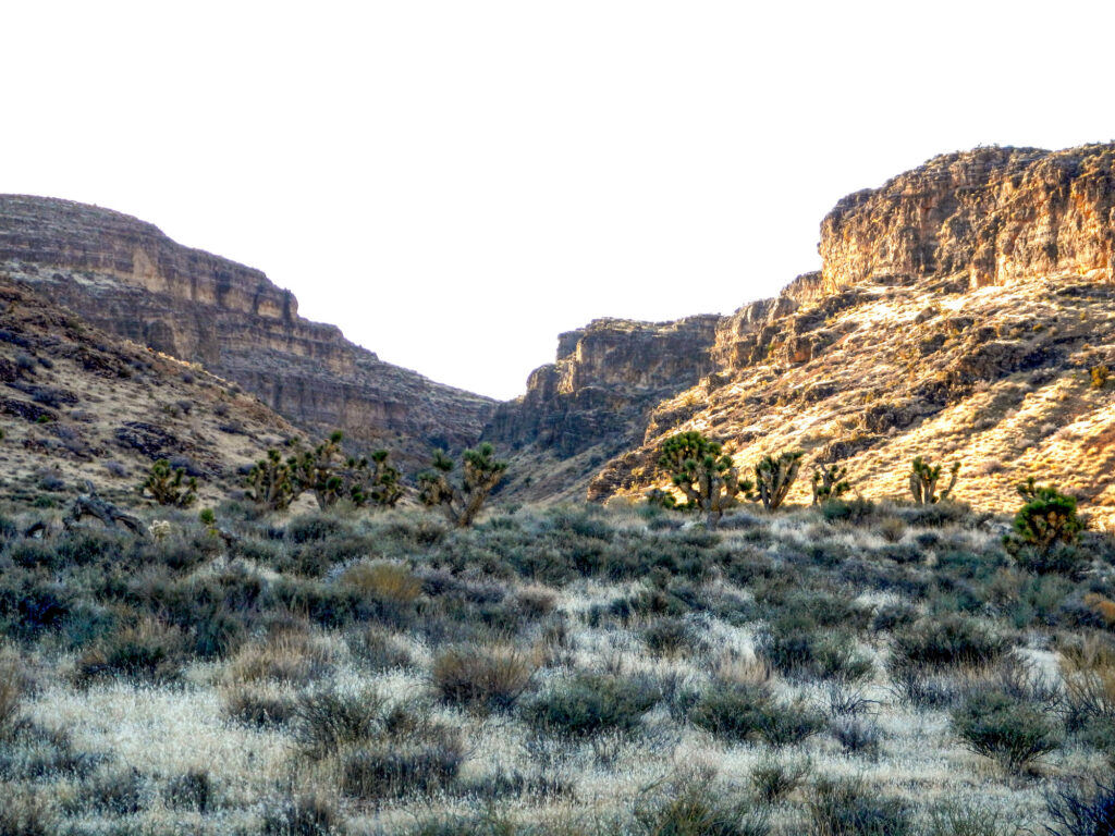
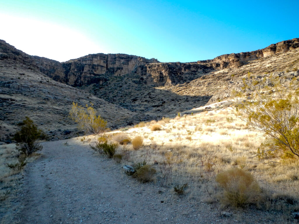
Continue to follow this path as it takes you through another wash and into a canyon. At first, it will seem that you have gone too far but this trail is taking you up the gradually sloping eastern side.
Once you start heading uphill the trail will split. Follow the path to the left and it will start taking you back northwest and towards the Muffin Top. From here until you get to the top, you will get a pretty good workout as it is mostly uphill to the top.
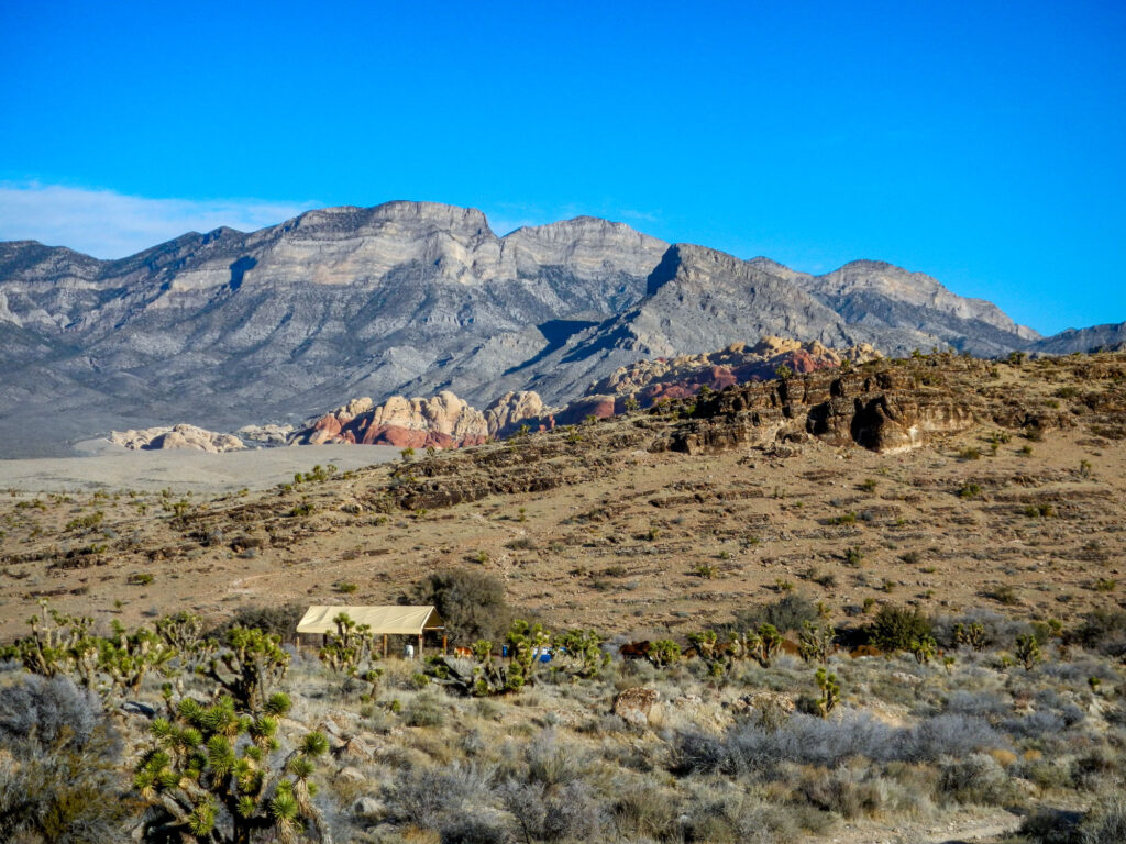
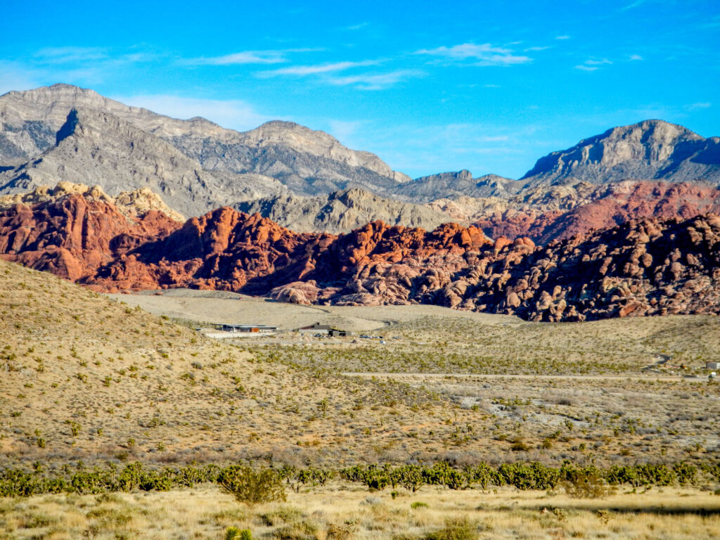
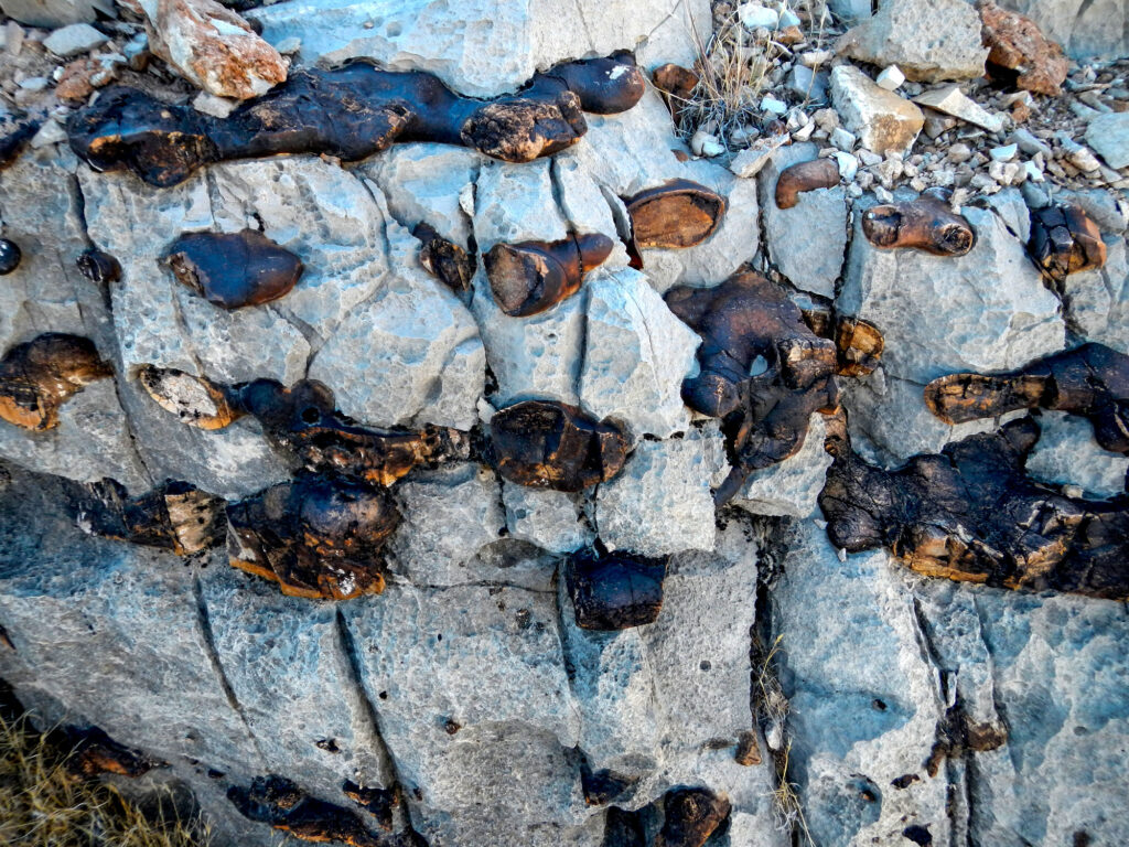
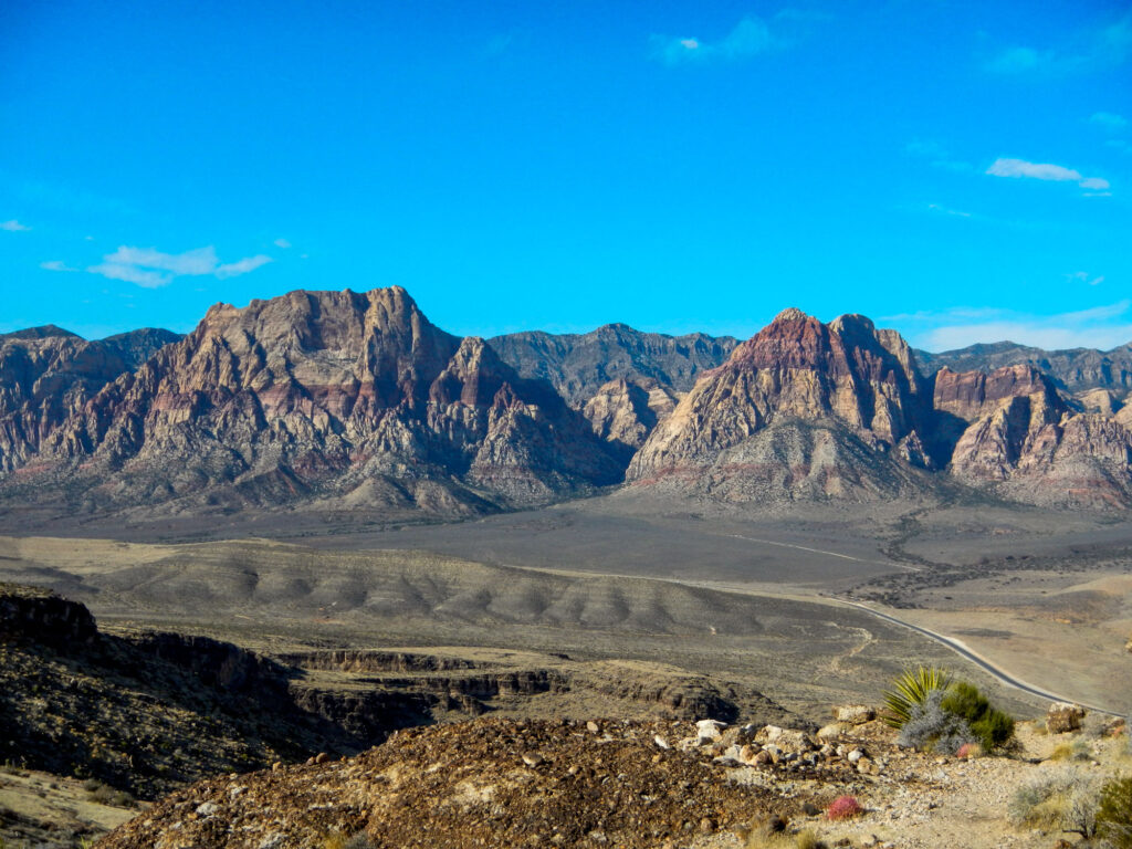
Along the way you will pass some pretty cool rock formations where the Red sandstone seems to almost be oozing out of the other rocks and many fossils as well. As you hike higher up the trail you will get some amazing views of the Calico Basin, Turtlehead Peak, and the rest of Red Rock Canyon.
Once you reach the top, snap some pictures with the Las Vegas skyline or Red Rock Canyon in the background, or hang out and enjoy the views. When you are ready just retrace your steps back to the parking lot.
About The Red Rock Canyon National Conservation Area
Located in southern Nevada, about 20 miles from Las Vegas, Red Rock Canyon National Conservation Area is one of the most popular tourist destinations in Southern Nevada. The area is a favorite among locals and tourists alike for its stunning red rock formations and hiking trails.
In addition to hiking, visitors to the Red Rock Canyon National Conservation Area can also enjoy the picturesque 13-mile scenic drive with pull-offs and picnic areas. Right outside the park are opportunities for horseback riding and mountain biking.
Similar hikes to the Las Vegas Overlook Trail
Calico Tanks Trail
Fossil Ridge Trail
Kraft Mountain Loop Trail


