Hiking Kraft Mountain Loop at Red Rock Canyon
Kraft Mountain Loop, also known as Gateway Canyon Loop is a great hiking trail just outside of the Red Rock Canyon Scenic Loop at Red Springs. It is a low-difficulty trail with a nice mix of desert, uphill, and canyon hiking that circles around Kraft Mountain.
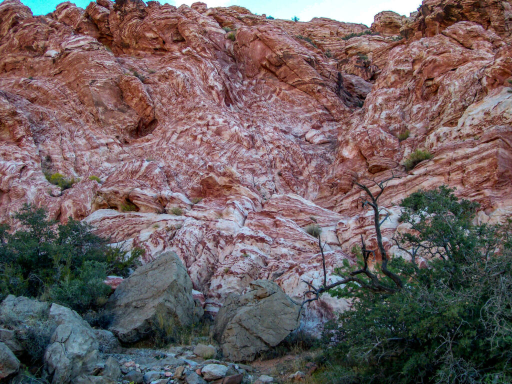
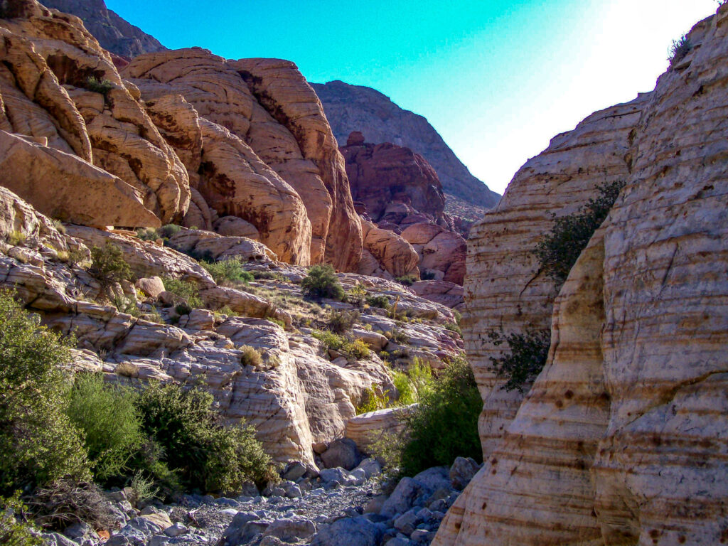
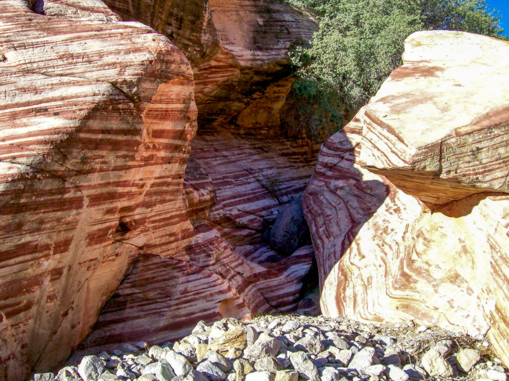
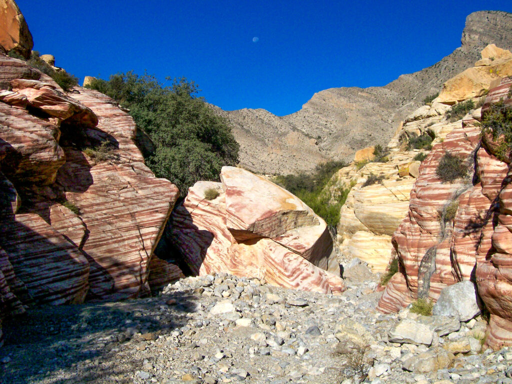
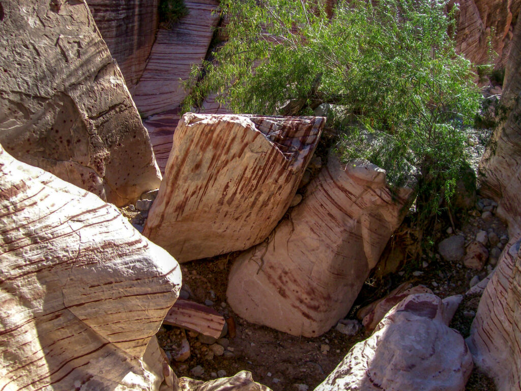
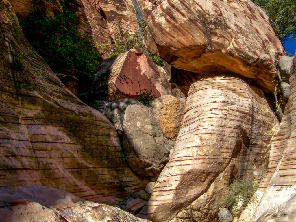
The canyon is lined with amazing candy-striped sandstone that at some points is close enough to touch both sides. There is a little scrambling but nothing too extreme for beginners. The hike is considered moderate and is about 3.25 miles long for the entire loop.
Kraft Mountain Loop is a popular hiking trail because it is just outside of the Red Rock National Conservation area so there is no fee to access this trail.
How to Get to Kraft Mountain Loop
To get to Kraft Mountain Loop at Red Springs just follow Charleston Rd (State Highway 159) to Calico Basin Rd which is right before the entrance to the Red Rock Scenic Loop if you are heading South. Follow the road until you see the sign for the picnic area parking lot. Make a right onto Calico and then the first left onto Assisi Canyon Ave.
Follow the road as it curves to the right which will be Sandstone Dr. Go straight until it dead ends and there will be a gravel parking lot on the left. The trail starts on the North side of the lot.
Hiking Kraft Mountain Loop
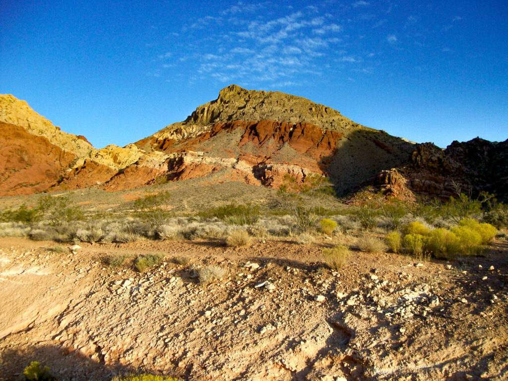
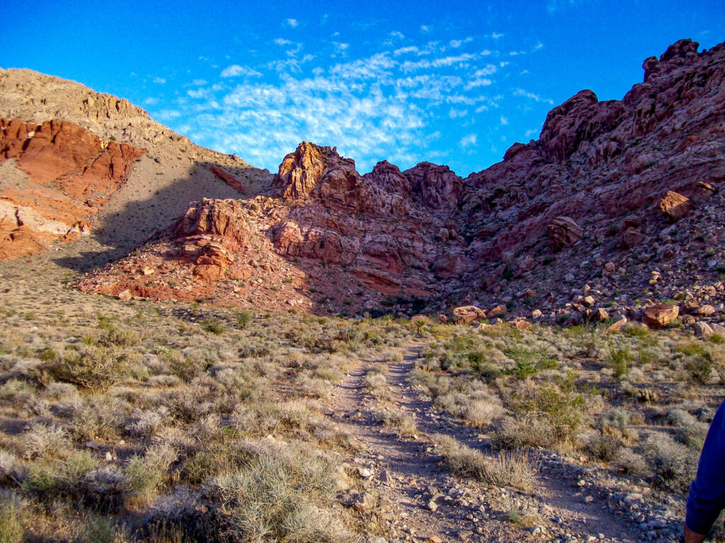
Once you leave the parking area, there are many interconnecting trails so just pick one heading Northwest towards the saddle between Kraft Mountain and Greycap Mountain. The trails will eventually combine into one that starts to move upwards between the two mountains.
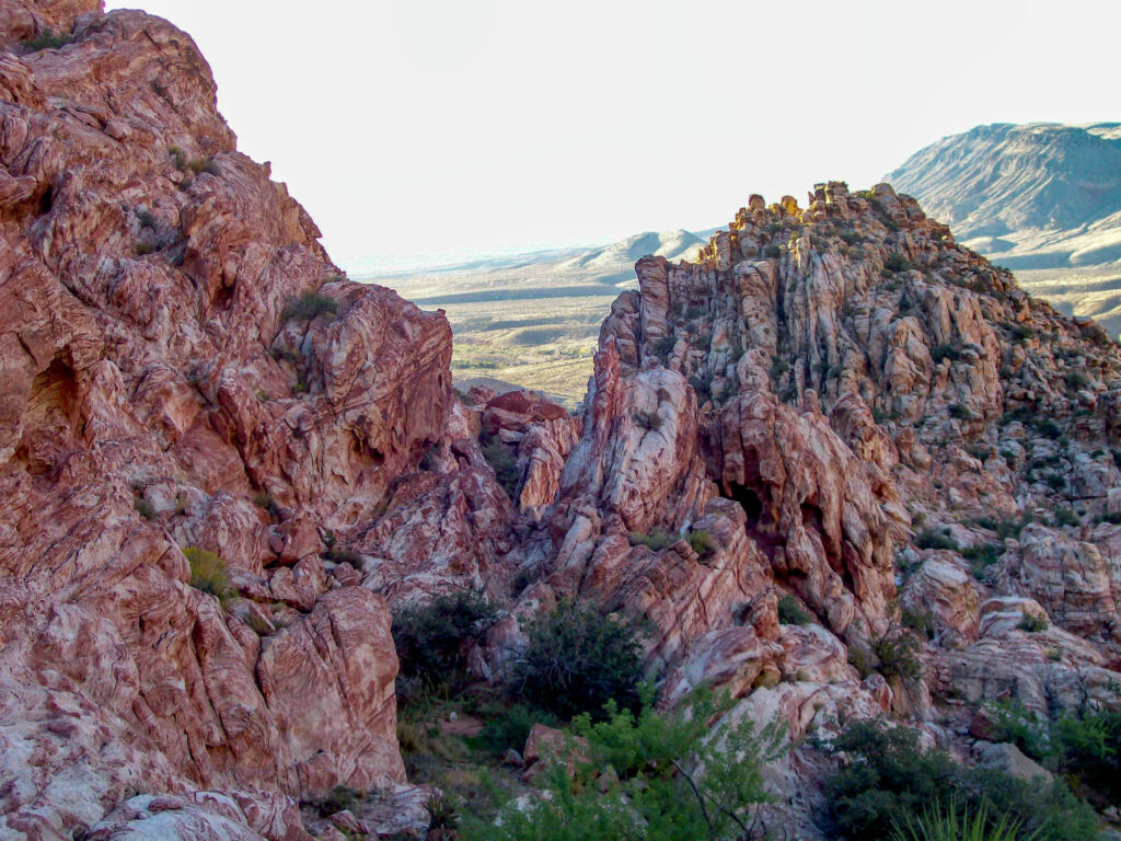
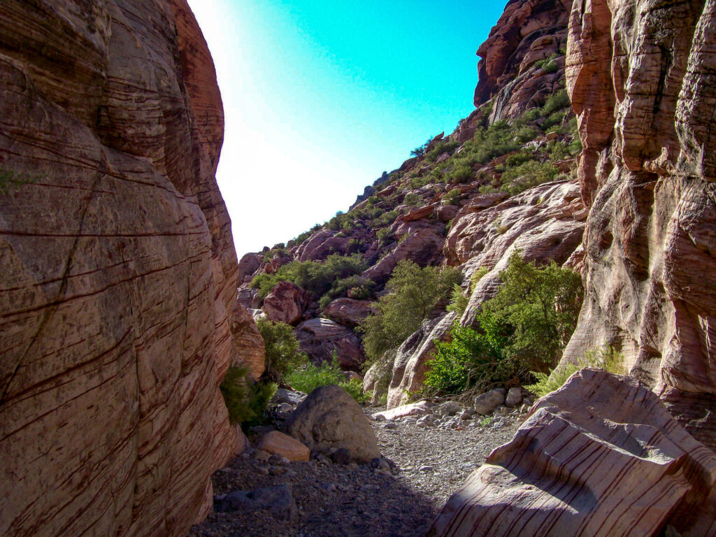
Continue to follow the trail upwards until you reach the top of the saddle where you should look back for some great views of Calico Hills and Turtlehead Peak. At this point, you will start to see some of the red and pink stripings in the rocks that make this hiking trail interesting.
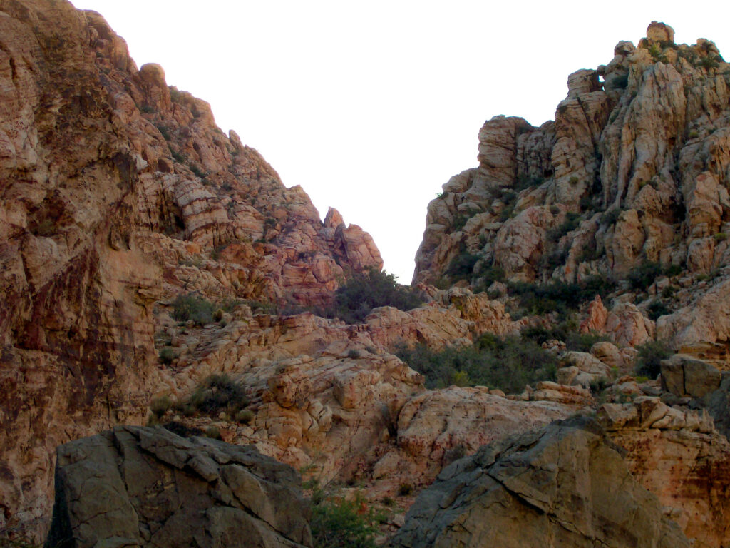
Once you make it to the wash, hang a right and head into the canyon. As you make your way through the candy-striped canyon you will run into some scrambling and some large obstacles but there are paths around them. There are a couple of drop-offs to navigate but none are very difficult and there is usually another route around the major obstacles.
Once you start to come out of the canyon you will see some dirt trails that will hug Kraft Mountain to the right. Continue along these paths until you come to the rock garden which is an area scattered with hundreds of large boulders and very popular with rock climbers. It is actually fun to watch the climbers try to navigate their way up the giant boulders.
After the rock garden, continue on an angle through the desert back towards the parking lot.
About The Red Rock Canyon National Conservation Area
Just 20 miles from the Las Vegas strip you will find Red Rock Canyon National Conservation Area which is one of the most popular tourist destinations in Southern Nevada. The area is a favorite among locals and tourists alike for its breathtaking red rock formations and mountain views.
In addition to its 26 hiking trails, visitors to the Red Rock Canyon National Conservation Area can also enjoy the 13-mile scenic drive with its many pull-offs and secluded picnic areas. Just outside Red Rock Canyon visitors can also find opportunities for mountain biking and horseback riding.
Similar hikes to the Kraft Mountain Loop
White Rock Mountain Loop Trail
Calico Hills Trail
Las Vegas Overlook Trail