
Hiking Keystone Thrust Trail at Red Rock Canyon
Keystone Thrust Trail is a great hiking trail for beginners and those who are not too familiar with the scrambling. The trail is very easy to follow and does not involve any scrambling or climbing.
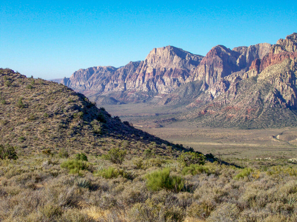
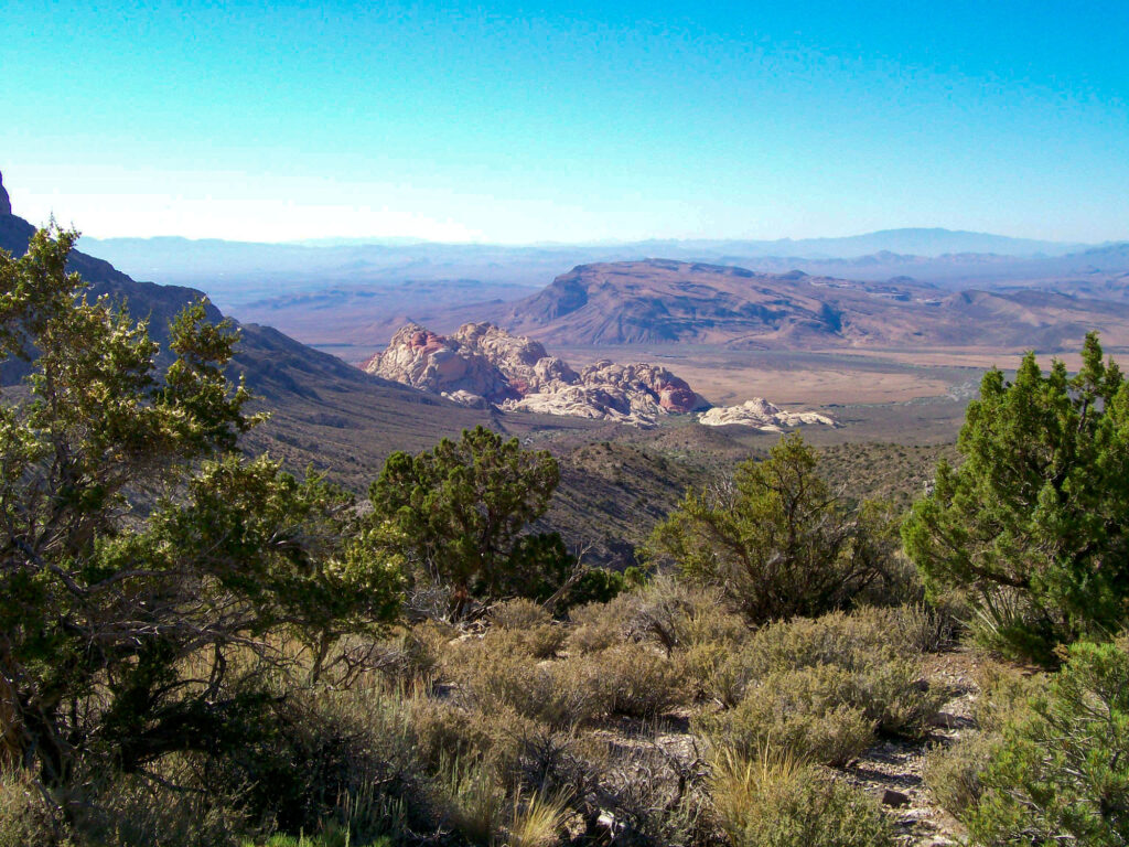
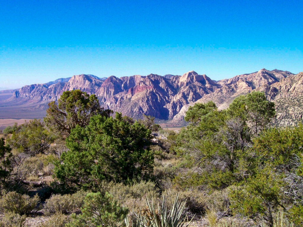
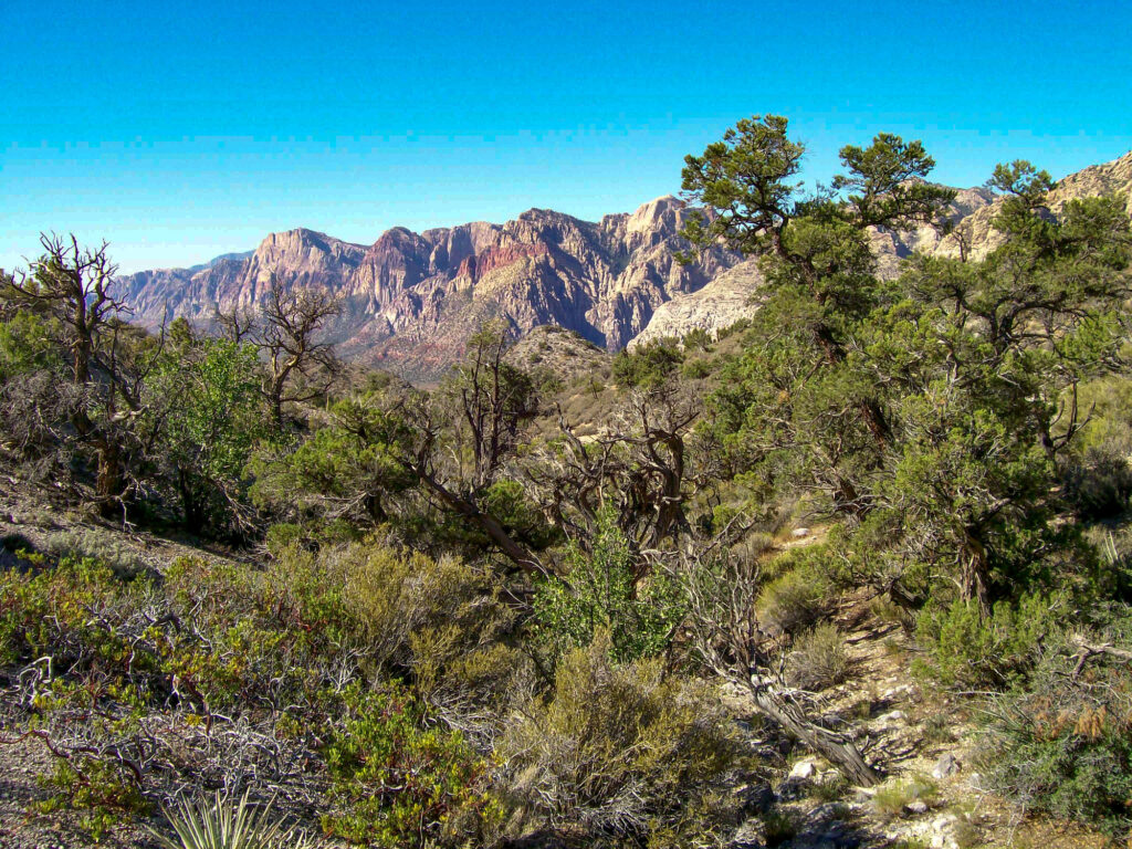
It is a down-and-back hike of a little over 3 miles total and will give you beautiful views of the surrounding mountains and most of Red Rock Canyon.
There is a steady but not steep incline on your way up the trail so you do feel like you got a workout from the hike. At the end of the hike, there is the Keystone Thrust Fault line which is studied by geologists from around the world.
How to Get to the Keystone Thrust Trail
To get to the trailhead just drive to Red Rock Canyon National Conservation Area on State Highway 159 and pull into the scenic drive. Go around to about 5.5 miles and hang a right onto a gravel road that will take you to the White Rock parking area.
Hiking Keystone Thrust Trail
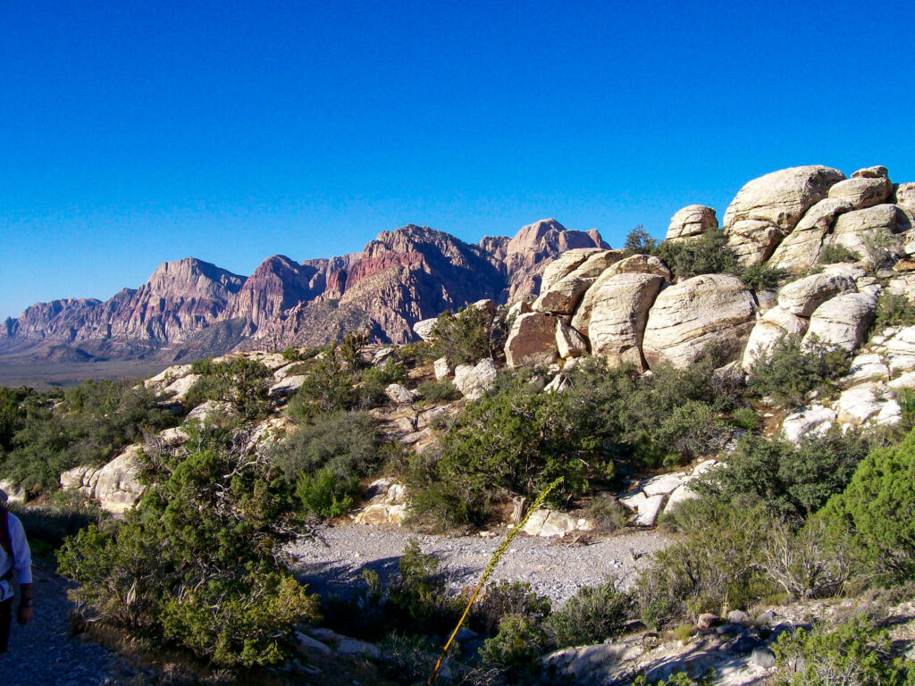
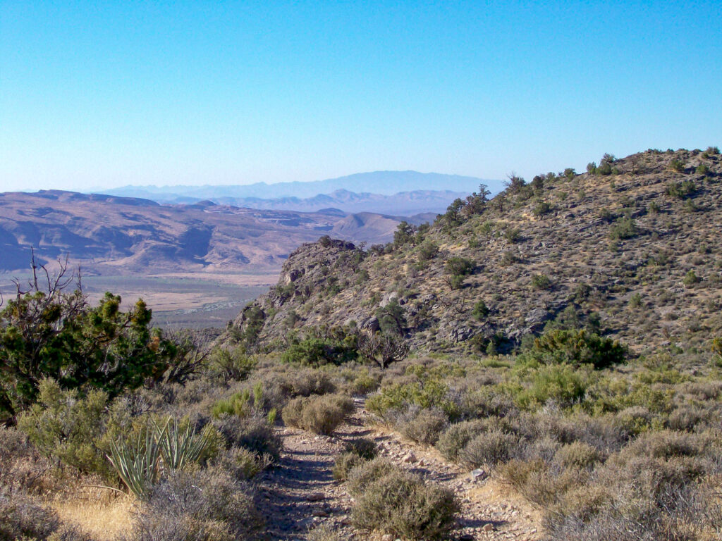
Follow the trail past some white sandstone boulders and into the wash. The trail will resume immediately on the other side of the wash. Follow about .3 miles until you come to a split in the trail and follow to the right up some stairs made of railroad ties. From there the trail is pretty straightforward and easy to follow.
There will be another split in the trail a little over .5 miles into the hike but continue straight. You can check out the other trail if you like on your way back.
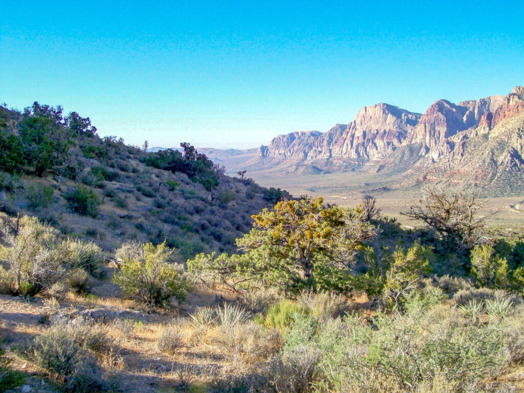
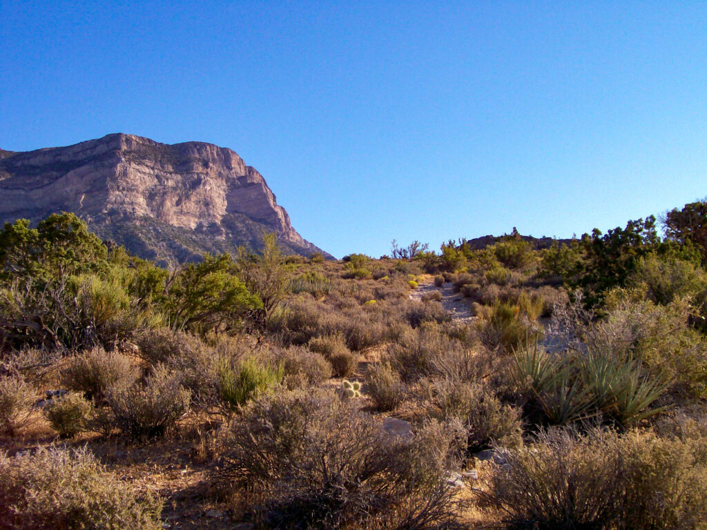
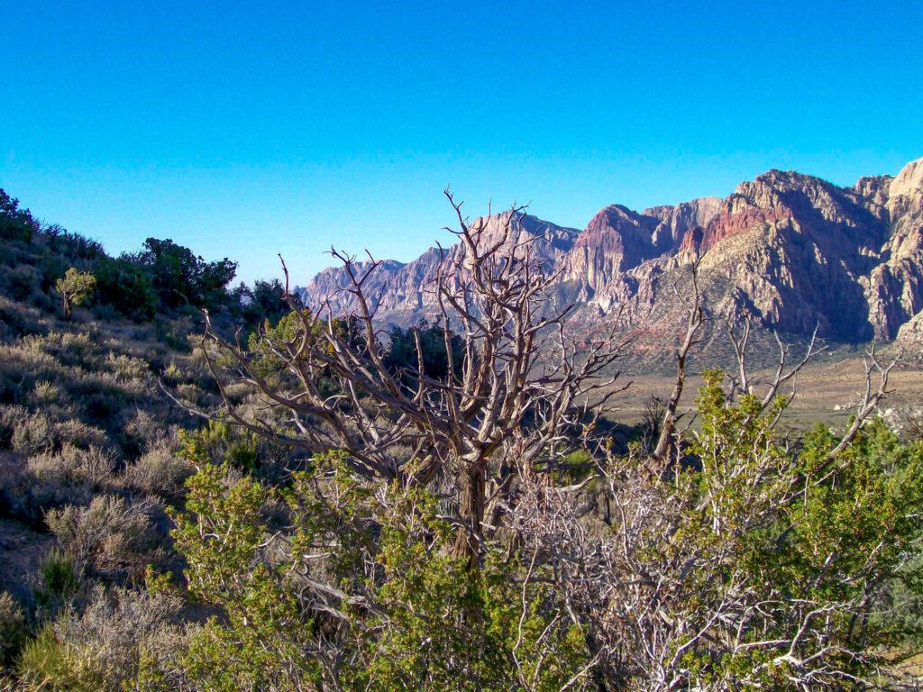
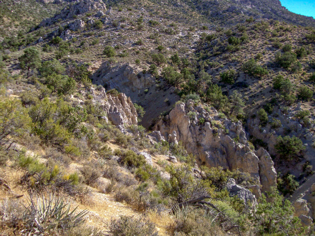
As you hike your way up the Keystone Thrust trail, take a few moments to look around and enjoy the scenery. You will be able to see how diverse the Red Rock Canyon National Conservation Area is with granite mountains mixed in with the red and white sandstone seeming to bubble out of nowhere.
There are also several hills along the way which are easy to walk up to get better views.
Keystone Thrust Fault Line
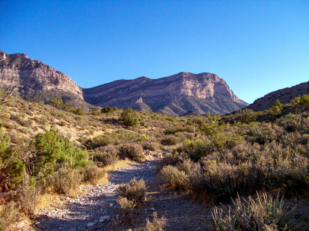
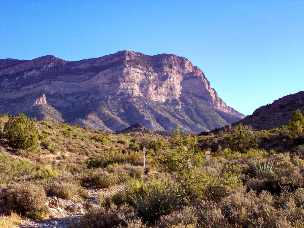
Once you reach the end of the trail you will see the Keystone Thrust Fault which seems like it has split the mountain in two. I am not sure if you can climb down into the fault, I am not that adventurous and it looked pretty steep.
Once you have had a good look at the fault just turn around and make your way back down the mountain. If you are in an adventurous mood, hang a left at the split in the trail that I mentioned early and follow the trail down to a nice area of red sandstone which is perfect for some easy scrambling. You can work your way down the sandstone and see where the water has carved some impressive sculptures out of the rocks.
Once again hiking the Keystone Thrust Trail is pretty easy so it’s perfect if you have smaller children or dogs but do remember to wear comfortable shoes and bring plenty of water as there is very little shade.
About The Red Rock Canyon National Conservation Area
Red Rock National Conservation Area is a great place to hike because of its stunning red rock formations and canyons. The area is home to over 26 hiking trails which vary in terrain and difficulty. The trails are easy to follow and offer a variety of options for hikers of all levels.
The area is easy to explore by driving the 13-mile scenic loop. Be sure to stop by one of the several overlooks along the way that make for great photo opportunities.
If you are looking to explore the area further, just outside the Red Rock National Conservation Area you will find more trails for free (no entry fee) hiking and mountain biking as well as opportunities to explore Red Rock Canyon on horseback.
Similar hikes to the Calico Hills Trail hike
La Madre Springs Trail
Fossil Ridge Trail
White Mountain Loop Trail


